
Your Horsham Township Neighbors by Parcel
The public, local route for identifying a block begins with an address and its parcel. Montgomery County's assessment system is the entry point for a physical address or parcel ID. County GIS adds the nearby parcel outlines and TAXPIN values. The Recorder can then add a documented party and recorded instrument. Each source has a narrow purpose. It can describe land or a record transaction, but it cannot establish who occupies every home around a Horsham Township address.
| Block source | What it can show around an address | Access route |
|---|---|---|
| Assessment parcel record | Site address, TAXPIN or parcel context, and assessment result facts | County Property Records by address or parcel ID |
| County parcel GIS | Parcel geometry, TAXPIN, alternate ID, type, acreage, and spatial relationship | County parcel map service |
| Recorded document index | Document party, date, instrument, legal description, and plan clue | Recorder Public Access System |
| Voter list request | Regulated election record list types, not an open block roster | County or state formal request process |
| Township community contacts | Open participation and civic contact leads | Horsham Community Contacts |
Start with the source that matches the question. Use the Horsham Township property and map trail for a parcel beside or across from an address. Use the Recorder for a dated ownership-document question. Use community contacts to ask about open programs, not to infer private membership. This keeps a neighbor search tied to records that actually support the result.
Map a Horsham Township Block
County GIS supports display, find, and identify functions for Horsham Township parcel features. The documented block method does not depend on a one-click neighbor or radius button. Begin in Property Records, then move to the map with a TAXPIN. Pan and zoom around the selected outline. Treat each touching outline or parcel across the roadway as an individual address-research lead. Common land, a right-of-way, a utility tract, commercial land, and a differently addressed lot can sit beside a home.
- Search the target street address in County Property Records and select HORSHAM where appropriate.
- Record the parcel ID or TAXPIN, property address, alternate ID, and any sale facts displayed for the matching parcel.
- Open the County GIS parcel layer, use display, find, or identify to locate that TAXPIN, and inspect the adjacent outlines and those across the street.
- Write down each nearby TAXPIN with its address context, then search each address separately in Property Records.
- Take an individual parcel to the Recorder only when a recorded-document trail is needed. Use a survey for a boundary question.
The official Montgomery County parcel GIS service is the map layer used for the Horsham Township neighbors workflow.
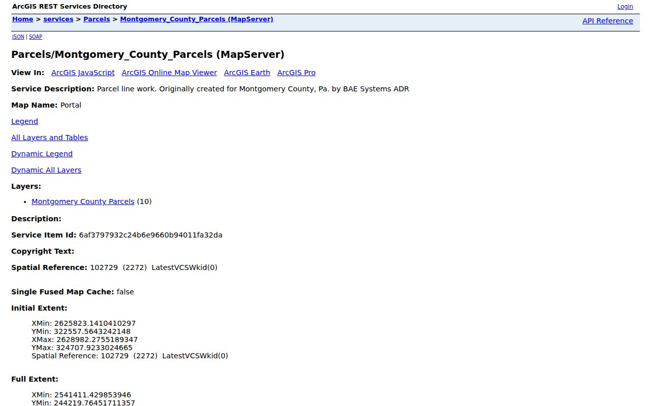
The parcel schema exposes TAXPIN, alternate ID, parcel type, calculated acreage, and geometry. Record the date of the view because County data and maps are refreshed regularly. The resulting map position is useful for a research trail, not a declaration that a particular person resides there.
For a complete named-street sequence rather than an immediate block, the Horsham Township street directory follows the address-to-parcel path in greater detail.
Horsham Township GIS Is Not Survey
A Horsham Township parcel map makes nearby geometry easier to inspect, but it is not legal boundary evidence. The County describes its map data as informational and visual. Only a licensed surveyor establishes ground boundaries. A line that appears to touch another parcel can conceal an easement, a right-of-way, common land, or a map-scale issue. Parcel type and calculated acreage are useful map attributes, not household facts.
This distinction matters when looking at Horsham Township neighbors. An owner shown in a property record can be a recorded party or mailing recipient. An occupant, other private household member, utility customer, or delivery recipient is not created by the map. Preserve the physical address, TAXPIN, and recorded document number before drawing any conclusion about a property relationship.
| Official record route | Commercial neighbor tools |
|---|---|
| Shows its custodian, search key, document or parcel context, and stated access limits. | May combine data from sources with different dates and unclear matching methods. |
| Lets a researcher compare an address, TAXPIN, legal description, or docket identifier. | Should be checked against the originating public custodian before any reliance. |
Use a Recorder document, County map, and assessment result as separate evidence. A commercial category result should never fill in a missing fact about a Horsham Township block.
Note: A parcel outline can guide a records search, but a licensed surveyor is required for an actual boundary determination.
Horsham Township Neighbor Deed Trail
Once a nearby Horsham Township parcel has been identified by address, use the Recorder's Public Access System to search the address or parcel ID. The Recorder identifies name, address, and parcel ID as search criteria and maintains permanent land records dating to 1784. Save the most recent deed's grantor, grantee, document date, book and page or instrument number, legal description, and any plan reference. Those facts let a later researcher test whether an earlier record concerns the same parcel.
The free index and a readable Horsham Township document image have different access paths. The Recorder requires an account for the Public Access System and says remote images require a subscription. Counter computers and written mail-copy requests remain available. A $10.50 e-certified copy is available through the Recorder's e-certified queue. For a plan, retain the plan book or case reference along with the TAXPIN, since a subdivision or lot clue can be a better bridge than a modern street number.
Do not label a recorded party as one of the current Horsham Township neighbors without a fact that supports that narrow claim. A deed records a party and land transaction. It does not list every current household member or resolve a private mailing arrangement.
Horsham Township Voter List Rules
Pennsylvania's personal voter-status form is for a Horsham Township voter checking that voter's own registration. It is not a name-by-street browser. The formal public route is controlled by Election Code Section 1404. Before inspecting a voter list or obtaining names and information, a requester must identify themself to the records custodian and state in writing that the data will not be used for unrelated purposes.
Montgomery County's Board of Elections request form says public-information lists are available to qualified registered electors under the Election Code and SURE regulations. It requires a government-issued ID copy to confirm registration, accepts requests through Voter Services, and says requests ordinarily receive a response within ten calendar days. The state form offers Public Information, Street, Walking, and Full Voter Export lists. That is a regulated election-data route, not a tool for collecting Horsham Township neighbors.
Montgomery County's voter-record request form states the identity and submission requirements. Protected voters and cancelled records are excluded from the full export, so absence cannot prove that someone does not live nearby.
Horsham Township Community Contacts
Horsham's official organization pages are useful for participation and public community contact, but they do not publish an HOA-wide or association-member directory. The Township describes Horsham Neighbors Association and Horsham ChATs as an effort to expand dialogue among citizens, Police, Fire, and Emergency Services. The Community Contacts listing provides the ChATs program and Neighborhood Watch number, 215-643-8284, as well as civic and service organizations.
Horsham ChATs
Township-listed neighborhood-watch and community-dialogue contact. Use 215-643-8284 to ask about open participation, not private member information.
Local civic groups
The Township lists Horsham Rotary, Lions, the Greater Horsham Chamber, and the Horsham Interfaith Coalition as community organizations.
History and library groups
Friends of Graeme Park, Friends of Horsham Library, and HPHA are listed civic contacts with public participation roles.
The Township organizations inventory describes ChATs and its connected organizations. The Community Contacts page supplies the public contact list. No official source located a public member roster, so membership or household affiliation should not be assumed.
Horsham Township Block Planning Context
Public Horsham Township planning material can explain the setting of a block without identifying private households. Horsham's Comprehensive Plan was updated in 2025 and addresses growth, new development, historic resources, transportation, open space, facilities, parks, and land use. The 2025 Official Map Ordinance for the NAS-JRB area depicts roads, trails, facilities, utilities, public buildings, and open space. These documents can add context when a parcel pattern or roadway looks unfamiliar.
Horsham's road and settlement history also explains why present maps need date awareness. Expansion of Willow Grove Naval Air Station closed Keith's Road and Privet Road and absorbed Horshamville. A historic road reference should be compared with deeds, plans, tax lists, and maps rather than forced into a current address field. That is a property-history question, not evidence about present neighbors.
Horsham's Comprehensive Plan page provides the current official planning context. Planning and map material can describe an area or development era, but it does not create a resident list.
Note: Planning context helps interpret a parcel pattern, but ownership and household facts require their own dated records.
Privacy Boundaries for Horsham Township Neighbors
Public access has clear limits. The Pennsylvania Right-to-Know Law protects many personal identifiers, and agencies must redact protected portions where possible. Court policy also excludes confidential case material. PennDOT driver and vehicle information is not a block-research source, and no address should be inferred from a vehicle plate. A map, assessment result, or recorded deed should not be used to expose nonpublic personal details.
Pennsylvania's Address Confidentiality Program lets eligible survivors use a substitute address for specified court, state, voter, school, marriage-license, and utility records. Actual participant addresses are confidential. Voter exports also omit protected voters. A blank record, a different mailing address, or a no-result can reflect those lawful limits and is not permission to search around them.
Lawful use. Horsham Township neighbors records are for personal, lawful property and community research. Pennsylvania harassment and stalking laws prohibit using a result to threaten, watch, intimidate, or harm another person.